-
About Upazila
Introduce to Upazila
History & Tradition
Geography & Economic
-
Upazila Parishad
Current Parishad
Activities
-
About Upazila Administration
Upazila Nirbahi Officer
About Organogram
Schedule & and Meeting
- Lama Municipality
-
Government office
Law and order is a matter of security
Education and culture
Agriculture, fisheries, animal and food matters
Health and environmental issues
Engineering and information and communication technology
Human resource development issues
ভূমি ও রাজস্ব বিষয়ক
-
Different Institutions
Educational Institutions
Religious Institutions
- e-Services
- Gallery
- Communication
- UGDP
- Logic Project
-
About Upazila
Introduce to Upazila
History & Tradition
Geography & Economic
-
Upazila Parishad
Current Parishad
Activities
-
About Upazila Administration
Upazila Nirbahi Officer
About Organogram
Schedule & and Meeting
-
Lama Municipality
লামা পৌরসভা
-
Government office
Law and order is a matter of security
Education and culture
Agriculture, fisheries, animal and food matters
Health and environmental issues
Engineering and information and communication technology
Human resource development issues
ভূমি ও রাজস্ব বিষয়ক
-
Different Institutions
Educational Institutions
Religious Institutions
- e-Services
-
Gallery
Photo Gallery
Video Gallery
Covid-19 reg
-
Communication
Communication Lama Upazila
-
UGDP
Activities
-
Logic Project
Local Adaptation Plan of Action
লজিক প্রকল্প (২০২৩-২৪)
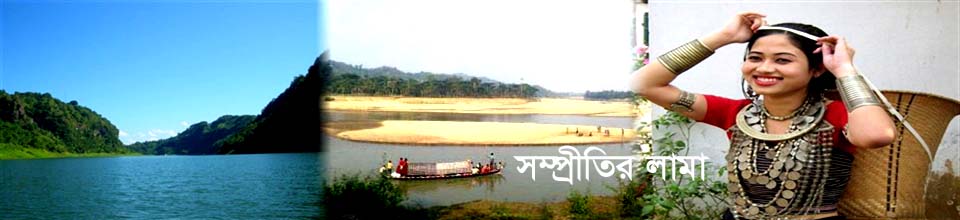
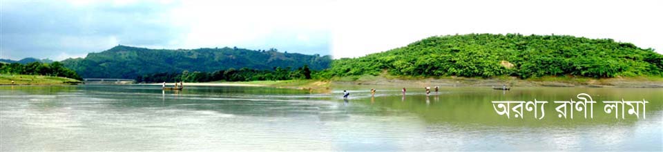
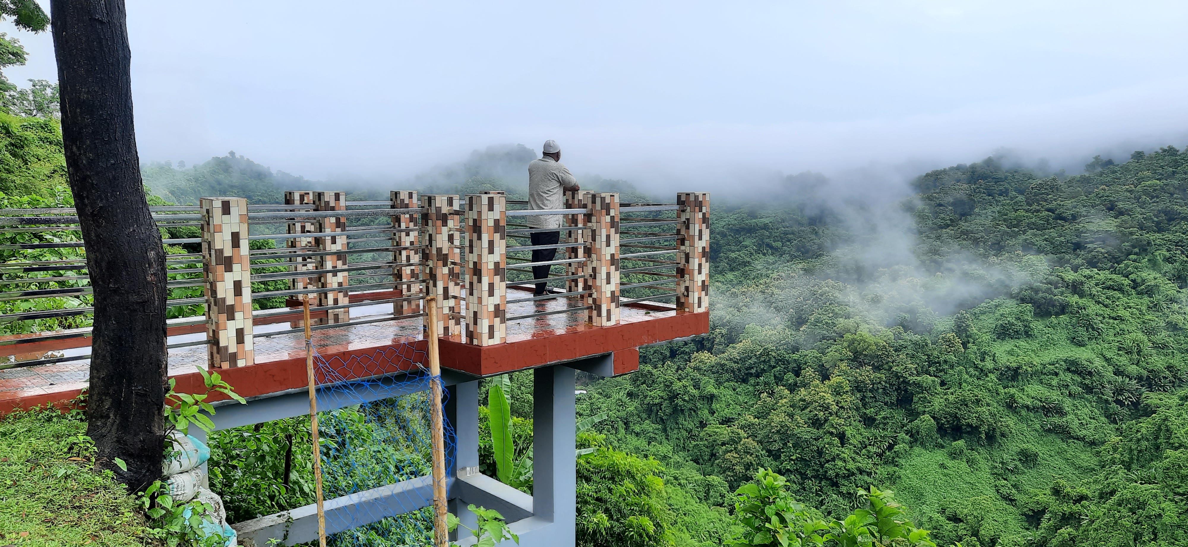
Lama Municipality was formed on 17 May 2001 as a class B municipality with an area of 28.49 sq km. Which is surrounded by hills around the city of Lama and is bordered by the Matamuhuri River. Bandarban is a hill district surrounded by immense beauty and green hills. With the highest number of 11 small ethnic groups, the highest peak Tajingdong, mountain rivers and innumerable natural scenery, this hill district is glorious. Life here, livelihood, social rituals are full of variety. There are many places to visit in Bandarban. These places have become very popular with tourists from home and abroad day by day. Welcome to Bandarban. Meghla, Nilachal, Swarna Mandir, Nilgiri, Shailprapat, Rizhuk Jharna, Keukradong, Bagalek, Chimbuk are some of the places of interest.
In the heart of the city is the Marma Para, a symbol of the hill people. At present about 35,806 people live in this city. On one side of the city is Matamuhuri College, on the other side is Alikadam Cantonment. The city has a total of 24.44 km of paved roads, 14.22 km of semi-paved roads and 17.6 km of unpaved roads and 2.50 km of paved drains.
The town of Lama has two hat bazaars, a government hospital, a government college. Secondary high school has 1 government and 2 non-government institutions. Literacy rate among the town people is 37%. Municipal council consists of 9 male councilors, 3 reserved female councilors and 1 elected mayor in 9 wards. Citizen services include cleaning the city, lighting roads, constructing and repairing roads, drains, culverts.
Municipality class: "B".
Date of establishment: 17/05/2001
Date of the first meeting: 08/05/02.
The activities of the municipality started on 01/07/01.
Date of appointment of administrator: 10/06/01.
The date of the first election of the municipality is 02/04/02.
Date of taking oath of elected council: 25/04/02.
Taking power of the second municipal council: 17/02/2011.
The date for the election of the third municipal council is 30/12/15.
Gazette publication date: 12 January
Date of swearing in of the third municipal council: 24/01/16
Date of taking power of the third municipal council: 03 February '18.
Date of the first meeting of the third municipal council: 11 February '18.
Date of 4th Municipal Council Election: 16 January 2021.
Date of publication of Gazette of 4th Municipal Council: 25 January 2021.
Date of taking oath of 4th Municipal Council: 11th February, 2021.
Date of the first meeting of the 4th Municipal Council:
College: 1.
High schools: 3 (1 government + 2 non-government).
Non-secondary schools: 2 (non-government).
Senior Madrasa: 1
Dakhil Madrasa: 1.
Primary schools: 13
Forkania Madrasa: 9
Hefz Khana: 5
Gita Shiksha Niketan: 1.
Area: 28.49 sq km.
Boundaries ঃ North: Bamu Bilchhari, and Ghazalia.
South: Ward No. 1 of Lama Sadar Union and Alikadam Upazila.
East: Matamuhuri river.
West: Ward No. 1 of Lama Sadar Union and Matamuhuri River.
Total population: 35,806.
Male: 18,611.
Women: 17,195.
Mouza: 02 (Goat Khaiya + part of Ghazalia Mouza).
Educational Institutions: 46
Raw road: 18.8 km
Paka ঃ 17.67 km,
Half ripe: 24.44 km
Paved drain ঃ 2.50 km
Raw Drain: 2.00 km
Mosques: 18
Buddhist temples: 08
Hats and bazars ঃ 2.
Literacy rate: 57%
Apart from this, the Municipal Dispute Resolution Board, Nationality Certificate, Birth Registration Certificate, free medicine and ambulance are provided to the needy people of the city. Pure water supply and various services are provided to the victims during different disasters. There are plans to further strengthen the provision of civic services by increasing revenue by adopting income generating projects of the municipality. Construction of city roads, sewerage modernization, and children's park are underway by 2025.


Planning and Implementation: Cabinet Division, A2I, BCC, DoICT and BASIS
Technical Assistance:
![]()
Developed By:
